Today’s stats: wake up height: ±30m, hike start: 1377m, hike finish: 2153m, highest point: 2374m, hike length: ±19km, hike start: 10:30, hike finish: 18:30
 We woke up, and packed our things. This involved me swapping my finished book with a fresh one that was left behind in the apartment: Ron Hubbard’s “To The Stars” – in Dutch(!). That’s actually why I had few qualms about swapping the book – I mean, there were other books in Dutch, and who in their right minds (apart from me) is going to read a Dutch book while on Tenerife, near the beach?
 The evening before, Aga had suggested getting up early and try to hitchhike — buses on Sunday are very infrequent here, and today we’d have a long hike, so the sooner we start, the better. However, reality prevailed, and we slept nicely and cosily. Till seven thirty. Can you spot the difference between my regular style of holidays and this type of holidays? I reckoned you could :)
 After finishing the packing, we checked out, and picked up some supplies in the local tiny mercado: four 1.5 liter bottles of water, and some buns, ham and cheese for lunch. We then made it to the bus stop with plenty of time to spare – which gave us time to grab a quick breakfast across the street. Again, I realised how convenient it is that Aga spea
 ks Spanish fluently — and that she understands Spanish culture. I probably would have had quite a fight with the waitress over my order. It was a simple hot bun with molten cheese, but they have a specific name for hot buns (or somesuch) in Spanish, which confuses the hell out of me. Not Aga though: she happily chats away in Spanish, and we’re quickly fed and back at the bus stop.
 We got off the bus in Vilaflor, and now take the time to decently adjust the backpacks. I’ve never hiked with all my holiday-stuff on me before, nor ever with a trekking backpack. There’s all these straps and buckles and whatnots that can be tweaked, fiddled with and adjusted. You can even change where the shoulder straps are attached to the backpack! This is necessary too, as I’m taller than Aga. Hmms, this is fun! I fasten the belt-buckle so that the weight is on my hips. I’ll be tweaking this a bit more, but for now it seems to work reasonably. Aga dashes into a shop to pick up a bottle of coke, and we’re off!
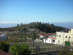
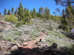
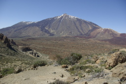
And 200 meters further, we’re greeted by a wonderful view (see first picture). After a bit of a search through the village for the start of our route, we find a hiking map on the central square:
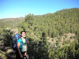
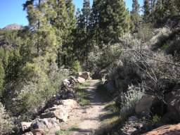
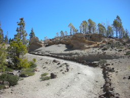
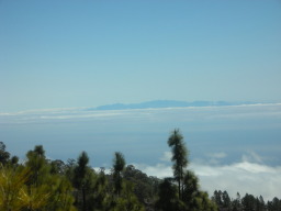
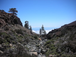
(Not our full route, this is merely the start.) In addition, the friendly local tourist office supplied some signposts — we are on our way! There’s plenty of gorgeous views – see the above photos and these few:
 |
 |
 |
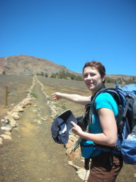
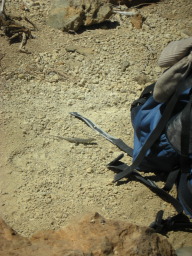 After a long and gorgeous hike through quite varying terrain sorts, we circle Montaña de Guajara and take a longish break there. Taking shoes and socks off, and sitting back in the sun. Grabbing a bite to eat, and waiting for the group of loud Spanish youngsters to continue hiking, so that when we start, we can hike in peace. During our break, we even make a friend (see the photo)! Unfortunately, one thing we overlooked (we were tired, but still): me and sun, us don’t get along. I don’t really notice it while we’re taking the break, but the sun is burning down on me. Even the top of my feet gets burned! And I did put on sun screen all the time:
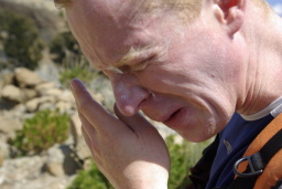 |
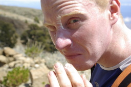 |
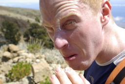 |
So when we continue, I am burnt and don’t feel too great. On top of this, the first part is downhill (or down slope, if you prefer), which is the first time I notice the lack of proper hiking shoes. I keep slipping. So I have to constantly be on my guard, while I’m feeling rather low on energy. (on a sidenote: this is cheating! we’re supposed to hike up Teide, and that is higher than where we are right now… and we’re going down?? Aw man!)
All in all, by the time we hit the main road, I’m drained. The views are still splendid:
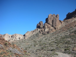 |
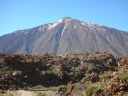 |
 |
But I’m being grumpy and sullen now. Luckily, shadow helps, and after several spots in the shade, I’ve recuperated to the point of not grating too much on Aga’s patience (I hope — she didn’t beat me up that night, so I’m guessing I was improving to the point of bearableness). Moreover, this is the final part, it can’t be far now! just a few hundred meters, right? At most two km?
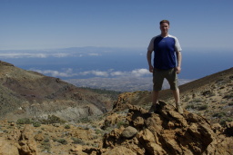 Wrong! It’s a solid 3.5 km — which in this terrain, and given our fatigue and desire to take photos, translates into a hike of more than one hour. Ouch. Didn’t see that one coming. When we get to our hotel, Aga has some energy left to jump into the shower. Me? I just crash on the bed. I can feel my body being warm all over the place. After some friendly suggestion from Aga regarding the odeur I am wafting about, I decide to drag my warm ass from the bed and jump in the shower. I figured I’d have a cold shower, but somehow I don’t quite get there — the warm water feels so soothing. So, halfway through showering, I plug the drain and fill up the bath, and recline in there for half an hour. When I get out, I feel quite refreshed again, and ready to go on! My enthusiasm is slightly tempered by Agnieszka, who fell asleep while I was bathing.
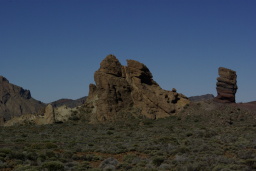
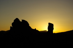
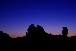
 So when we go down for dinner in the restaurant (incidentally, the hotel is in the middle of nowhere: no shop, no nothing, so the only options for food and drink are the hotel), we inquire to check-out times and order sandwiches and coke for the day after (the coke (in case you’re confused: coca cola, not the drug) kept Aga’s spirits up today, so we figure it’s best to stock up on it. We’re all set, and go to the restaurant and place our orders. It takes a while before our food arrives, and suddenly we find ourselves in the restaurant, with a view of Teide and the surrounding natural park, at dusk. Aga dashes off to get her camera to snap some pics, while I patiently wait. She did take a few beautiful photos (see below), but not at the restaurant. By the time she returns, it’s just a tad too dark for decent photos.
 |
 |
 |
Despite our preparations for an early start, we realise it is an incredible challenge — and that after this day’s strenuous hike… about 19km, starting at 1377 meters altitude, finishing at 2153, with a max height of 2374 in between when we skirted Montaña Guajara (see the height profile for details)… well, I’m not sure if hiking another 20km tomorrow, including a hike up to the highest point in Spain, is a realistic idea.
We come up with wild alternatives: take the cable cart, go up, to top, back down by cable cart, hike to refuge. Et cetera. In the end, we decide to hike to the refuge tomorrow, and then the day after to leave early. If you’re sleeping in the refuge, you’re allowed on the top without a permit — as long as you clear off before 9:00. (That is 9am, aka 9 o’clock in the morning — this is different from my regular style of holidays, I keep telling you… :)

